
Project overview
A Perth-based engineering client engaged QOffshore to develop an automated processing methodology for a tidal and GNSS observation programme involving approximately 18 bottom-mounted tide-gauge nodes.
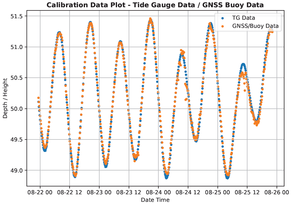
Each node combined pressure-based tidal observations with barometric data and GNSS observations acquired from a buoy positioned above the tide gauge for approximately 75 hours or more. The technical objective was to derive and validate the separation between Lowest Astronomical Tide (LAT) and the ellipsoidal reference surface at each node.
The challenge
The dataset incorporated multiple instruments, reference points and time series. Producing a reliable result required substantially more than matching the tide-gauge curve with GNSS heights. Every observation had to be checked, corrected and referenced through a consistent, defensible methodology.
The processing sequence contained more than 35 principal stages, with calibration, parameter and QA/QC requirements within individual stages. Repeating the complete sequence manually across approximately 18 nodes would have required significant specialist effort and created a risk of inconsistent handling between datasets.
QOffshore’s solution
QOffshore converted the hydrographic and geodetic methodology into a tailored processing workflow designed around the client’s tide gauges, barometers, GNSS buoys and file structures.
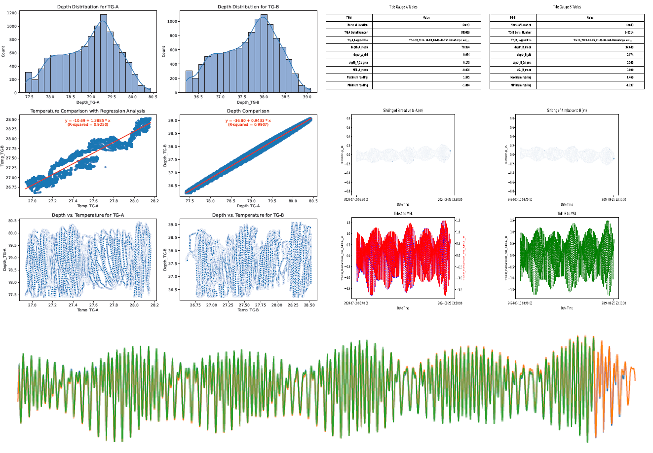
The workflow addressed:
- pre-mobilisation calibration information;
- file, timestamp, sampling and unit validation;
- time-offset and clock-drift assessment;
- atmospheric-pressure correction;
- pressure-sensor stability and drift assessment;
- temperature and pressure behaviour;
- outlier detection and controlled exclusion;
- filtering, including Kalman filtering where appropriate;
- Van de Casteele assessment where applicable;
- seasonal mean sea-level considerations;
- synchronisation of corrected tide-gauge and GNSS observations;
- regression, residual and time-series analysis;
- derivation of the ellipsoid-to-LAT separation; and
- automated production of QA/QC plots, tables and processing records.
Technical validation
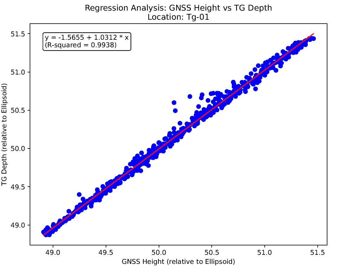
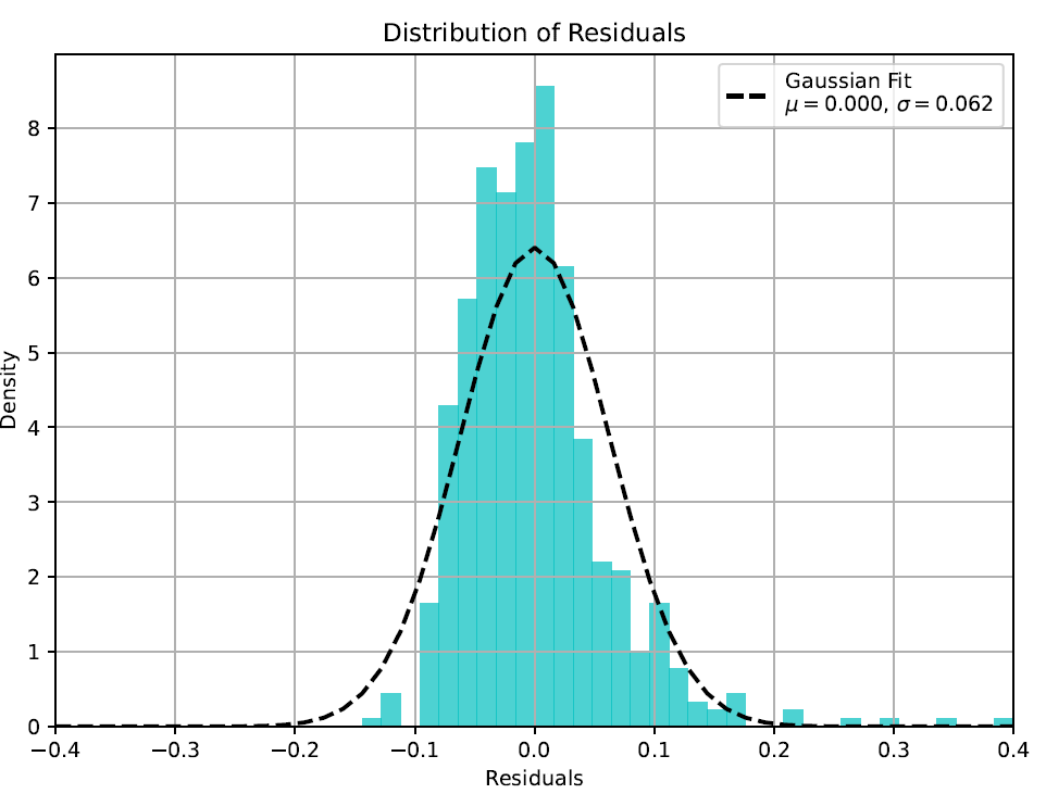
QOffshore retained specialist review gates throughout the automated process. Paired tide-gauge and GNSS observations were evaluated through time-series comparison, regression analysis and residual assessment. These checks supported identification of outliers, timing inconsistencies, unexpected instrument behaviour and observation periods unsuitable for the datum calculation.
The automated tools did not replace technical judgement. QOffshore’s domain knowledge was required to define the sequence of operations, select appropriate corrections, establish acceptance controls and interpret the results within the limitations of the sensors and observation period.
Project outcome
The client received a processing methodology tailored to its own GNSS and tidal instrumentation rather than a one-off set of calculations. The resulting workflow can be applied consistently across the current programme and reused for planned projects over the coming years.
For the initial project, the client estimated that the automated methodology avoided approximately AUD 150,000 in processing costs. Further value is expected through reuse of the tools, reduced repetitive handling and consistent QA/QC across subsequent deployments.
Key value delivered
- A repeatable workflow covering more than 35 controlled processing stages.
- Consistent processing across approximately 18 tide-gauge nodes.
- Integration of pressure tide-gauge, barometer and GNSS-buoy observations.
- Traceable corrections, filtering and statistical validation.
- Equipment-specific tools suitable for reuse on future projects.
- Client-estimated first-project savings of approximately AUD 150,000.
QOffshore delivers marine survey data processing and automation solutions founded on hydrographic, geodetic and offshore project experience. Contact QOffshore Services to discuss a tailored workflow for tidal, GNSS, hydrographic, geophysical or GIS datasets.