
Hydrographic Survey Services
CPHS Level 1 Certified · ISO 9001 | 14001 | 45001 · 20+ Years Offshore Experience
Our service is not a generalist survey offering. It is led directly by a Certified Professional Hydrographic Surveyor at CPHS Level 1; the highest professional certification grade in hydrographic practice with over 20 years of offshore and marine survey experience across Australian waters, KSA, PNG, Vanuatu, New Caledonia, and the Philippines. Whether you require hydrographic surveying for port infrastructure, coastal engineering, or offshore development, our team delivers results that meet the highest technical and regulatory standards.
What Qoffshore Delivers
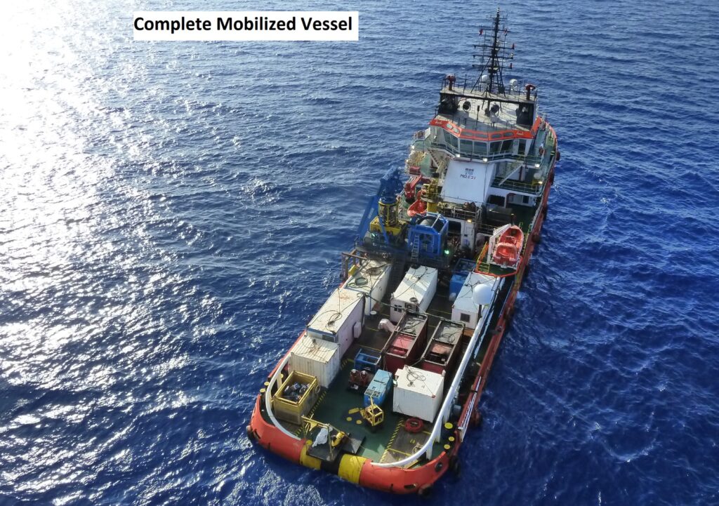
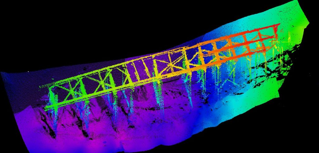
A hydrographic survey from Qoffshore produces accurate, defensible spatial data covering water depth, seabed morphology, tidal conditions, shoreline interfaces, and navigation hazards. Survey programs are planned and executed using multibeam bathymetry (MBES), single-beam echo sounders (SBES), GNSS, INS, tide gauges, and sound velocity sensors. Every dataset goes through a documented QA/QC process including tide correction, sound velocity correction, motion compensation, geodetic alignment, and final surface generation.
Need a Hydrographic Survey?
Scope of Hydrographic and Bathymetric Survey Services
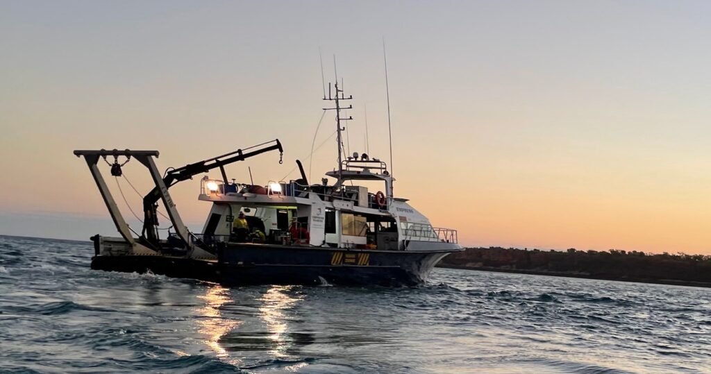
Hydrographic Survey Planning and Execution
Geophysical Survey Support
Survey Management and Client Representation
Data QA/QC and Processing
Tide and Geodetic Analysis
Charting and GIS Deliverables
What Separates QOffshore Hydrographic Survey from an Average Survey Contractor
Most hydrographic survey providers are built around acquisition: vessels, sensors, and field crews. That’s the core business. Qoffshore is built around a different proposition, taking survey and seabed data and turning it into engineering decisions, QA/QC-assured deliverables, and technical recommendations that your project team can actually use.
- Senior Technical Involvement on Every Project
- Engineering Interpretation, Not Just Data Delivery
- ISO-Certified, Auditable Delivery
- Outsourced Specialist Capability (On Project Terms)
- Multi-Location Experience: KSA, Australia (Perth and Cairns), Malaysia, the Philippines, and Egypt
- Automation-Supported QA/QC and Processing
Our Credentials and Certifications
CPHS Level 1 Hydrographic Surveyor
ISO 9001:2015
| ISO 14001:2015 | ISO 45001:2018
Which Sectors We Serve
- Councils and port authorities
- Engineering consultancies
- Marine contractors and vessel operators
- Oil and gas operators
- Offshore renewable and submarine cable developers
- Commercial diving and subsea inspection companies
- Island infrastructure and construction projects
Why Clients in Australia Work With QOffshore
Many large hydrographic survey companies focus on fleet scale and global mobilisation capability. QOffshore takes a different approach.
We operate as a specialist consultancy built around senior technical involvement, responsive project support, and practical offshore experience. Clients work directly with experienced hydrographic professionals who understand survey operations, offshore construction requirements, geophysical interpretation, and engineering constraints.
Our work is grounded in technical clarity, defensible reporting, and fit-for-purpose delivery.
Clients engage QOffshore when they need:
- Independent survey QA/QC
- Offshore survey-management support
- Hydrographic consulting input
- Cable-route and seabed assessments
- Engineering-focused survey interpretation
- Practical offshore experience
- Flexible specialist capability
- Reliable GIS and reporting deliverables

From Survey Data to Engineering Decisions
Hydrographic data alone does not solve offshore problems. The value comes from understanding what the seabed conditions mean for construction, cable installation, dredging, marine operations, environmental approvals, and long-term infrastructure performance.
QOffshore helps clients move from raw offshore information to practical engineering decisions supported by reliable hydrographic interpretation, structured QA/QC processes, and clear technical reporting.
From early-stage desktop studies through offshore acquisition support and final deliverables, we provide hydrospatial expertise that supports design, permitting, construction, and operational confidence.
Frequently Asked Questions
What Is The Difference Between A Hydrographic Survey And A Bathymetric Survey?
A bathymetric survey focuses specifically on measuring water depth and seabed shape. A hydrographic survey is broader and may also include positioning, tides, seabed features, geophysical data, infrastructure mapping, and offshore engineering support.
Who Needs Hydrographic Survey Services?
Hydrographic survey services are commonly used by offshore-energy developers, marine contractors, engineering consultants, ports, councils, environmental consultants, oil and gas operators, and infrastructure developers. These surveys support offshore planning, construction, permitting, inspections, and long-term asset management.
What Equipment Is Used During Hydrographic Surveying?
Modern hydrographic surveying may involve multibeam echosounders, side-scan sonar, GNSS positioning systems, tide gauges, LiDAR systems, ADCPs, and motion sensors. The equipment selection depends on project objectives, water depth, seabed conditions, and required survey accuracy.
When Is A Hydrographic Survey Required?
A hydrographic survey is typically required before dredging, offshore construction, submarine cable installation, port development, bridge construction, coastal engineering, or environmental approvals. Surveys may also support asset inspections, seabed monitoring, and marine hazard assessments.
What Deliverables Are Included In A Hydrographic Survey Project?
Typical deliverables include bathymetric surfaces, GIS layers, route charts, survey QA/QC reports, tidal and geodetic reports, CAD files, seabed-feature mapping, survey specifications, and final technical reports. These outputs support engineering, environmental, permitting, and construction decisions.