
About Us

QOffshore is a specialized hydrospatial and geosolutions provider, delivering advanced services in data process automation, hydrospatial management, desktop studies, and consultancy for the energy sector. Our expertise extends to Cable Burial Risk Assessments (CBRA) and field- and site-based desktop studies, ensuring safe, efficient, and compliant subsea infrastructure planning.
Through our proprietary platform, QMap, we bring geospatial intelligence, monitoring, and project management together in one place, helping clients streamline operations, optimize decision-making, and maintain full visibility across offshore activities.
Our Services Overview
- Desktop Studies and Burial Assessment Studies
- Cable Burial Risk Assessments
- Cable Routing and Feasibility Assessments
- Crossing and Seabed Mobility Analysis
- Survey Management and Data Interpretation
- Stakeholder Liaison and Regulatory Support
- Data Process Automation
- Geophysical and Hydrographic Survey Planning and Execution
Survey Management and Data Interpretation
We plan, specify and manage hydrographic, geophysical and geotechnical surveys tailored to each project’s needs. Our services cover vessel and equipment selection, survey line planning, data quality control and health and safety management. After acquisition, our geoscientists process and interpret data to build integrated ground models, produce detailed charts and GIS layers, derive engineering parameters and provide actionable recommendations for route engineering, burial depth and installation methodology.
Cable Burial Risk Assessments
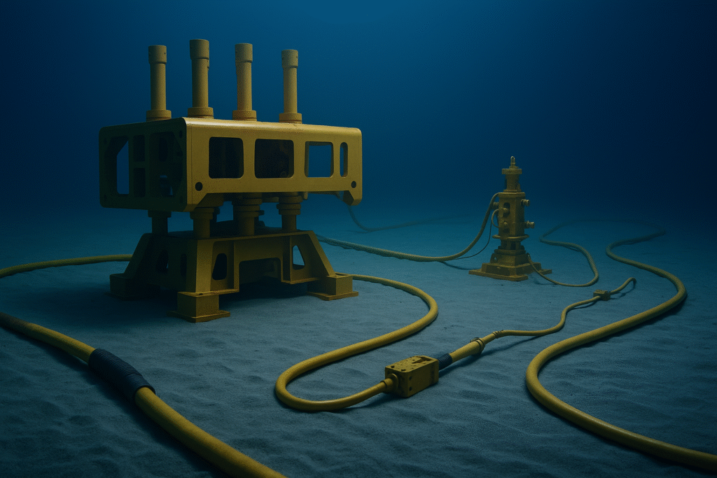
Protecting your cable from external damage is critical. We conduct cable burial risk assessments that analyse seabed composition, sediment mobility, human activities (such as fishing and anchoring) and environmental factors. Using numerical models and geospatial data, we calculate anchor strike and trawl risk, recommend burial depths, and identify where additional protection (e.g., rock dumping or mattressing) may be required to minimise the risk of exposure or damage.
Route and Crossing Engineering
We design and optimise submarine cable routes by evaluating seabed conditions, environmental constraints and existing infrastructure. This includes detailed analysis of alternative routes, identification of potential hazards, and planning of safe crossings over existing pipelines, cables or other seabed assets. We prepare crossing agreements and technical plans to ensure that routes are both technically viable and cost effective over the life of the system
Geophysical and Hydrographic Survey Planning and Execution
We execute integrated surveys that map seabed topography, subsurface structure and environmental conditions along the proposed route. Nearshore, shallow and deep water sections are surveyed using multibeam echo sounders, side scan sonar, sub bottom profilers, magnetometers and other sensors as appropriate. Our survey plans incorporate weather windows, tidal conditions and logistical constraints to maximise efficiency and data quality. We deliver processed data and preliminary interpretations within hours of acquisition, enabling timely route adjustments and supporting burial depth calculations and installation planning.
Crossing and Seabed Mobility Analysis
Our specialists assess how mobile sediments, currents and seabed morphology could affect your cable over time. By analysing seabed mobility and scour potential, we design stable crossing solutions and select protective measures that account for future seabed changes. We also model interactions at crossings with pipelines or cables, ensuring that installation methods and separation distances meet industry guidelines and minimise mutual interference.
Stakeholder Liaison and Regulatory Support
Successful cable projects require close cooperation with a wide range of stakeholders. We engage with regulators, fisheries, marine users, landowners and local communities to obtain permits and crossing agreements and to address concerns. Our team prepares regulatory submissions, environmental and social impact documentation, and ensures compliance with national and international standards. Effective stakeholder management reduces project delays and fosters positive relationships throughout the project lifecycle.
Survey Management and Data Interpretation
We plan, specify and manage hydrographic, geophysical and geotechnical surveys tailored to each project’s needs. Our services cover vessel and equipment selection, survey line planning, data quality control and health and safety management. After acquisition, our geoscientists process and interpret data to build integrated ground models, produce detailed charts and GIS layers, derive engineering parameters and provide actionable recommendations for route engineering, burial depth and installation methodology.
Cable Burial Risk Assessments
Protecting your cable from external damage is critical. We conduct cable burial risk assessments that analyse seabed composition, sediment mobility, human activities (such as fishing and anchoring) and environmental factors. Using numerical models and geospatial data, we calculate anchor strike and trawl risk, recommend burial depths, and identify where additional protection (e.g., rock dumping or mattressing) may be required to minimise the risk of exposure or damage.
Route and Crossing Engineering
We design and optimise submarine cable routes by evaluating seabed conditions, environmental constraints and existing infrastructure. This includes detailed analysis of alternative routes, identification of potential hazards, and planning of safe crossings over existing pipelines, cables or other seabed assets. We prepare crossing agreements and technical plans to ensure that routes are both technically viable and cost effective over the life of the system
Geophysical and Hydrographic Survey Planning and Execution
We execute integrated surveys that map seabed topography, subsurface structure and environmental conditions along the proposed route. Nearshore, shallow and deep water sections are surveyed using multibeam echo sounders, side scan sonar, sub bottom profilers, magnetometers and other sensors as appropriate. Our survey plans incorporate weather windows, tidal conditions and logistical constraints to maximise efficiency and data quality. We deliver processed data and preliminary interpretations within hours of acquisition, enabling timely route adjustments and supporting burial depth calculations and installation planning.
Crossing and Seabed Mobility Analysis
Our specialists assess how mobile sediments, currents and seabed morphology could affect your cable over time. By analysing seabed mobility and scour potential, we design stable crossing solutions and select protective measures that account for future seabed changes. We also model interactions at crossings with pipelines or cables, ensuring that installation methods and separation distances meet industry guidelines and minimise mutual interference.
Stakeholder Liaison and Regulatory Support
Successful cable projects require close cooperation with a wide range of stakeholders. We engage with regulators, fisheries, marine users, landowners and local communities to obtain permits and crossing agreements and to address concerns. Our team prepares regulatory submissions, environmental and social impact documentation, and ensures compliance with national and international standards. Effective stakeholder management reduces project delays and fosters positive relationships throughout the project lifecycle.
Our Services Overview
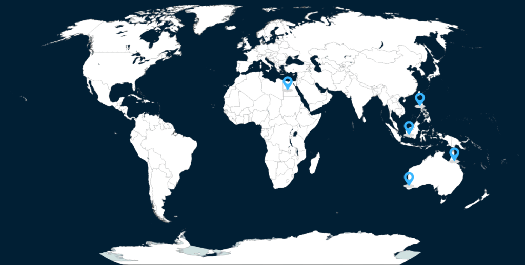
Perth
Philippines
Egypt
Malaysia
Cairns
Our Services Overview
Perth
Philippines
Egypt
Malaysia
Cairns