 Skip to content
INTEGRATED MARINE SURVEY · PAPUA NEW GUINEA
Hydrographic & Geophysical Survey in Papua New Guinea
One continuous seabed dataset, from shallow coastal water to depths beyond 335 metres.
Client
Tailored Spatial Solutions
Region
Papua New Guinea
Fieldwork
13–19 June 2026
QOffshore role
Hydrographic & geophysical survey subcontractor
Survey systems
Ping DSP · NORBIT Winghead · Innomar SBP
Survey vessel
Toanui
The client issue
Tailored Spatial Solutions needed a reliable picture of a coastal and offshore survey corridor for engineering interpretation and design integration. The work had to establish water depths, seabed shape and shallow subsurface conditions across an area where shallow embayments give way to steep, deep offshore terrain.
A depth chart alone could not provide the whole picture. Bathymetry, seabed imagery and sub-bottom profiles needed to share a common reference so the engineering team could use them together.
17.35 km²
Survey area
1.2–335.7 m
Observed depth range
1.5 m
Final bathymetric grid
3
Acoustic survey techniques
The survey challenge
01
A large depth transition
The corridor extended from approximately 1.2 m nearshore to more than 335 m offshore. Different acoustic systems were needed, with enough overlap to verify that their measurements joined consistently.
02
Combining three survey techniques
Bathymetry mapped depth and seabed shape, side-scan sonar recorded seabed imagery, and sub-bottom profiling investigated shallow material beneath the seabed. Their value depended on coordinated acquisition and interpretation.
03
A constrained coastal setting
Irregular shorelines, confined embayments, tides, navigation interfaces and changing water properties required adaptive survey planning and real-time coverage checks.
How QOffshore delivered the survey
Working from the survey vessel Toanui, QOffshore planned and delivered a coordinated hydrographic and geophysical programme. Mobilisation included measured sensor offsets, configuration checks and navigation-interface testing.
Nearshore acquisition: Ping DSP provided interferometric bathymetry and side-scan sonar in shallow sections.
Offshore and subsurface acquisition: NORBIT Winghead multibeam covered deeper water, while Innomar Compact sub-bottom profiling characterised shallow subsurface conditions.
Processing and integration: Qinsy supported acquisition and real-time coverage control. Qimera was used to clean, validate and merge the bathymetry, check crosslines and overlap, and generate the final 1.5 m surface.
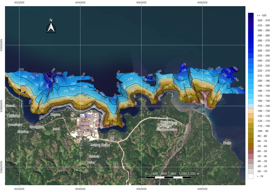
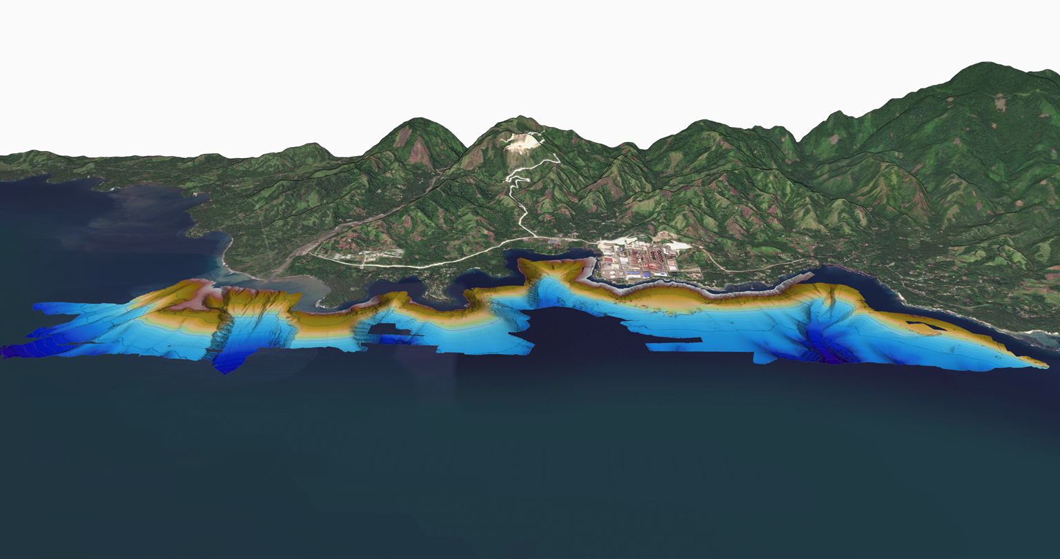
The overview shows the depth pattern in its coastal context. The 3D view at the top of this page makes the change in seabed shape easier to see. Together, these illustrate the coverage that had to be joined into one continuous model.
The result
Nearshore Ping DSP and offshore NORBIT Winghead bathymetry were merged into a continuous 1.5 m surface. Crossline and overlap checks identified no systematic vertical bias between the datasets.
The completed data were assessed as suitable for seabed interpretation, chart production, volume assessment and design integration. Final deliverables were submitted to and accepted by Tailored Spatial Solutions.
Survey deliverables
- Continuous 1.5 m bathymetric terrain model and XYZ point data
- Bathymetric contours, profiles and chart products
- Nearshore side-scan sonar and sub-bottom profile information
- Crossline, overlap and uncertainty quality checks
- Survey report supporting engineering interpretation and design integration
Why it mattered
The engineering team received one integrated technical record spanning nearshore and deep water. Common referencing and quality checks made it possible to compare and use the sensor outputs together, with clear continuity across the survey area.
This gave subsequent engineering work a consistent basis for understanding seabed geometry, assessing volumes and incorporating the survey into design, rather than having to reconcile disconnected survey products.
Explore our hydrographic survey services for water depths and seabed geometry, alongside our geophysical survey services for seabed imagery and shallow subsurface investigation.
