 Skip to content
Hydrographic services
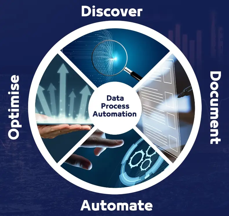
We revolutionize data processing automation by delivering tailor-made solutions designed to enhance operational efficiency, accuracy, and scalability. Developed by industry-certified experts, our solutions integrate cutting-edge technology and best practices to streamline workflows, minimize errors, and optimize decision-making. We ensure full compliance with international standards and regulatory frameworks, empowering businesses to meet industry demands with confidence while driving innovation and long-term success.
At Qoffshore, we follow a simple yet powerful rule of thumb: if a task is repetitive, time-consuming, and prone to human error, it should be automated. By leveraging intelligent automation, we reduce inefficiencies, eliminate bottlenecks, and enhance data integrity, allowing our clients to focus on higher-value operations and strategic decision-making.
Our automation solutions cover a wide spectrum of surveying and geospatial data processing, including:
Survey Mobilization & Demobilization Automation
Streamlining setup and shutdown procedures to minimize downtime.
Hydroid Development & Integration
Custom-built tools for hydrographic, geospatial, and offshore survey applications, allowing for seamless processing and real-time insights.
Automated Calibration & Processing Pipelines
Covering key offshore systems, including multibeam echo sounders (MBES), GNSS positioning, motion sensors, and sound velocity profiling.
Harmonic Analysis & Tidal Predictions
Utilizing advanced algorithms for tide and geodetic calculations, ensuring precise vertical referencing and depth corrections.
Data Quality Control & Standardization
Ensuring consistency, compliance, and reliability in all survey datasets.

Optimized Data Solutions for Accurate Offshore Operations
With expertise in hydrography, tide and geodetics, offshore operations, and harmonic analysis, Qoffshore ensures that every stage of your data lifecycle is optimized, accurate, and delivered with precision. By leveraging automation and hydrospatial intelligence, we empower survey teams to focus on delivering high-quality results without the burden of manual data processing.
Streamlined & Automated Offshore Data Management
At Qoffshore, we don’t just process data-we streamline, automate, and enhance the way offshore data is managed, ensuring faster turnaround times, improved accuracy, and compliance with global standards.

Streamlined & Automated Offshore Data Management
At Qoffshore, we don’t just process data-we streamline, automate, and enhance the way offshore data is managed, ensuring faster turnaround times, improved accuracy, and compliance with global standards.

Real-Time Offshore Monitoring with Qmap
Qoffshore supports its clients with Qmap, a fully in-house designed real-time monitoring tool that offers offshore operators unparalleled visibility and control over their assets. With cutting-edge technology, Qmap seamlessly integrates vessel tracking, wind data, and geospatial mapping, delivering a powerful yet intuitive interface for monitoring offshore operations with ease.
