Hydrospatial survey

Subsea and offshore consultancy

Hydrospatial survey

Comprehensive Hydrospatial Services for Offshore Excellence
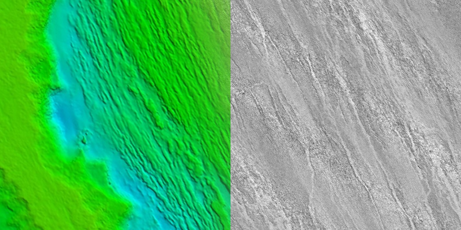
At Qoffshore, we provide a full suite of hydrospatial services designed to support the ever-evolving needs of the offshore energy, maritime, and marine infrastructure industries. With a focus on high-precision surface and subsea positioning, geophysical and hydrographic surveys, and advanced tide and geodetic analysis, we deliver data-driven solutions that enhance operational efficiency, safety, and decision-making. Surface & Subsea Positioning
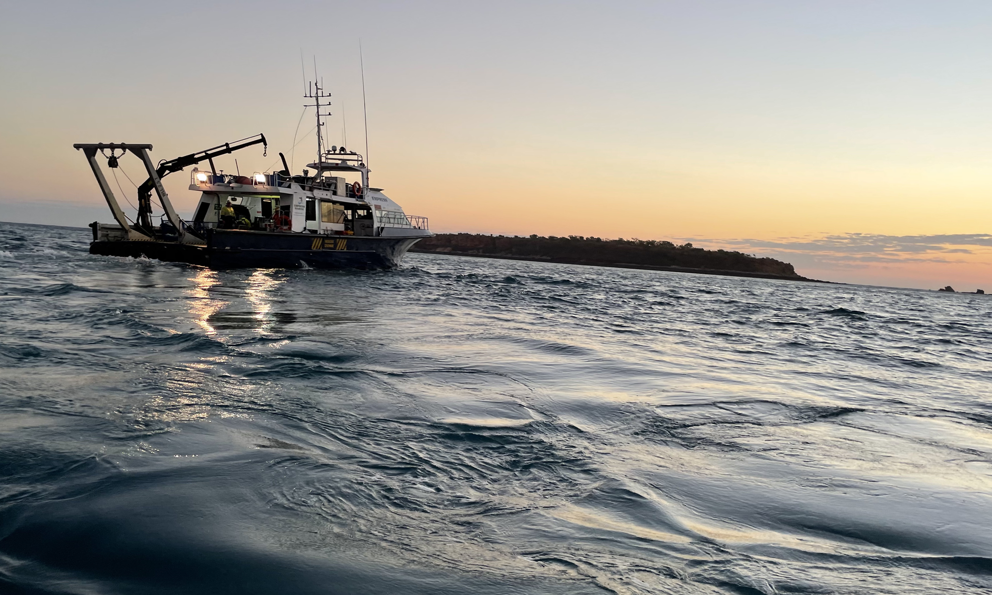
Accurate positioning is the foundation of any successful offshore operation. At Qoffshore, we utilize high-precision GNSS, INS, and acoustic positioning technologies (USBL, LBL) to ensure vessels, assets, and subsea structures are positioned with unmatched accuracy.

MBES Multibeam Echosounder

Our expertise extends across surface and subsurface positioning support, ROV and AUV tracking, rig moves, and pipeline/cable route installations, ensuring seamless operations in even the most complex offshore environments. 

Qoffshore’s geophysical and hydrographic survey services provide critical seabed and subsurface insights for offshore infrastructure development, hazard identification, and marine resource assessments. Using state-of-the-art multibeam echo sounders (MBES), sub-bottom profilers (SBP), side-scan sonar (SSS), magnetometers, and high-resolution seismic techniques, we generate detailed bathymetric models, seabed morphology maps, and geotechnical assessments to support offshore wind farm development, pipeline and cable route planning, and subsea asset monitoring.

Tide & Geodetics

Tidal and geodetic control is essential for depth referencing, hydrodynamic modeling, and accurate offshore construction planning. Qoffshore’s expertise in harmonic analysis, real-time and post-processed tide modeling, and geodetic transformations ensures that all survey data aligns with international hydrographic and geodetic standards. We provide precise vertical and horizontal referencing solutions, integrating data from GNSS tide gauges, geodetic benchmarks, and dynamic ocean models to deliver the most reliable water-level corrections and geospatial transformations for offshore projects.

By using a specific tools tailored for the use of the client application, we plan, control, execute and finalise the outputs of your tidal data to the required aspects

Survey Hydrographic
Why Choose Qoffshore?
  • Industry-Leading Expertise : Our services are designed and executed by Level-1 Certified Hydrographic Surveyors with extensive offshore experience.
  • Technology-Driven Solutions: We employ cutting-edge survey technologies, automation tools, and cloud-based processing to streamline data acquisition and reporting.
  • Global Standards Compliance: Our work adheres to FIG/IHO/IBSC, IOGP, and industry best practices, ensuring precision, reliability, and regulatory compliance.
  • Multi-Sector Experience: We support projects across offshore wind, oil & gas, subsea construction, port development, and scientific research.

At Qoffshore, we bridge the gap between data and decision-making, providing the insights you need to navigate offshore challenges with confidence. Whether you require accurate subsea positioning, detailed hydrographic charts, geophysical assessments, or tidal and geodetic solutions, our team delivers precision, efficiency, and operational excellence at every stage of your project.

Offshore Oil and Gas

Qmap

Qmap is Qoffshore’s innovative web-based mapping and data visualization platform designed to support hydrographic, geospatial, and marine projects. Built on the latest web technologies, Qmap provides an intuitive and interactive interface for professionals to explore, analyze, and interpret hydrospatial data with ease.

Scroll to Top